

Loscombe © Steve Masters
Alastair Cook
Location
Know before you go
Dogs
Please remove all dog mess from site. See above for more information about dogs on nature reserves.
When to visit
Opening times
Open at all timesBest time to visit
spring and summerAbout the reserve
A hidden valley in which to immerse yourself in the sounds of buzzards, bullfinches and babbling streams.
The reserve covers part of the upper reaches of this magical valley where geology reacts to produce interesting mosaic of neutral to acidic grasslands. The steep slopes are covered in yellow meadow anthills, nestling amongst these are plants such as wild thyme and bird’s-foot-trefoil. There are pockets of gorse and other scrub which support breeding linnets and many invertebrates. The slopes are bound to the north by a deeply sunken green lane, with old arching hazel stools on either side, which are home to bullfinch and dormouse.
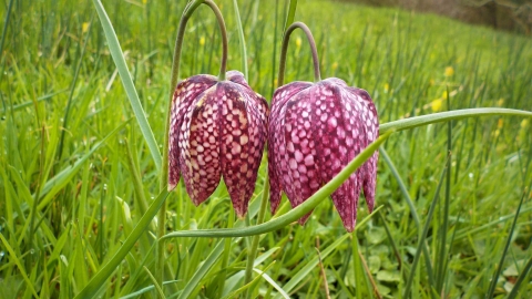
A small stream winds its way down through pockets of wet woodland, dominated by alder with opposite-leaved golden-saxifrage, and ringing with the calls of marsh tits. The lower, flatter fields give rise to a mix of wet marshy ground and a drier areas traditionally cut for hay. Here you can see southern marsh orchids and a small population of snakes head fritillary.
Useful Information
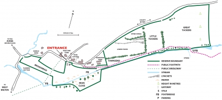
Turn right off the A3066 just outside Bridport heading for Mangerton and West Milton. At the start of West Milton village turn left onto Ridgeback Lane and then take first left to Loscombe down the narrow road to the bottom of the hill bearing right at the stream to head slightly uphill into the hamlet of Loscombe. The main reserve entrance gate and information board are on the right-hand side opposite Rose cottage. Parking in the field through the gate here in dry conditions (summer). At other times it may be possible to park one car at the bottom of the hill before the road climbs to the hamlet. By foot this reserve is accessed from a number of points from public rights of way.
Contact us
Environmental designation

Loscombe Nature Reserve Map


